DEVELOPING STRATEGIC INTELLIGENCE FOR THE CONSERVATION REGULATOR (ERP7)
The project Developing Strategic Intelligence for the Conservation Regulator (ERP7) aimed to contribute to the Office of the Conservation Regulator’s (CR) ability to regulate in a way that was risk-based and intelligence led. This was to be achieved through the exploration of new and emerging data and technologies to more proactively identify emerging issues and trends, as well as potential data driven patterns and relationships. The project focused on identifying and developing capabilities including systems and tools that would allow CR to capture, analyse and use data in more dynamic ways to assess the performance and functioning of its environmental compliance regulatory demands.
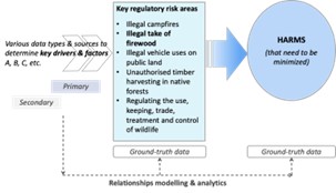
The exploration of historic and current data through advanced data modelling and analytics can help to identify and tackle gaps in strategic intelligence to improve strategic outcomes for CR. We prototyped the ERP7 product that could be used to understand and analyse historical trends from a wide array of data. Building on this baseline information, new modelling and analytical capabilities were applied to explore how existing but unused datasets and additional datasets could enhance analysis to gain insights, and subsequently shape new questions that might be addressed. This process was undertaken in close collaboration with CR.
In exploring the factors that may be related to minimise biodiversity harms, from our analysis, we observed that:
- Illegal domestic and commercial firewood collection activities count for most of the offences around Habitat Information Maps (HIM) for Victorian Rare or Threatened Species (VROT) species;
- The North-East regions contain the most critical IR (offences), and many of these happen close to HIM grids;
- The East and West regions contain vast VROT species but IR are rarely reported in these regions.
Such observations likely indicate uneven field monitoring and data collection priorities could be considered in under-monitored regions.
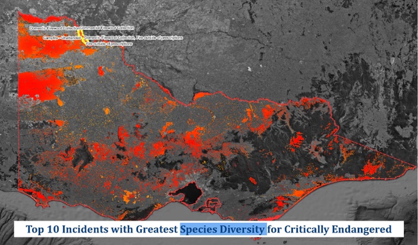
In the findings based on the very limited 6-8-month Incident Report data from Gumnut, we identified that a high likelihood of incidence occurring is linked to:
- Proximity to regions with a high degree of socio-economic disadvantages;
- Proximity to road networks, specifically, the “Local”, “2wd” and “4wd” road classes;
- Places with relatively flat (less than 5 degrees) topography and based on south-southwest-west facing grounds, which receive less sunlight.
Research Team:
- Prof Abbas Rajabifard
- Prof Greg Foliente,
- Prof Richard Sinnott
- Dr Yiqun Chen
- A/Prof Jagannath Aryal