Coastal flood platform
A Digital Twin project
A data visualiser and distributer to share with those interested in visualising the coastal flood impacts both globally and regionally.
Overview
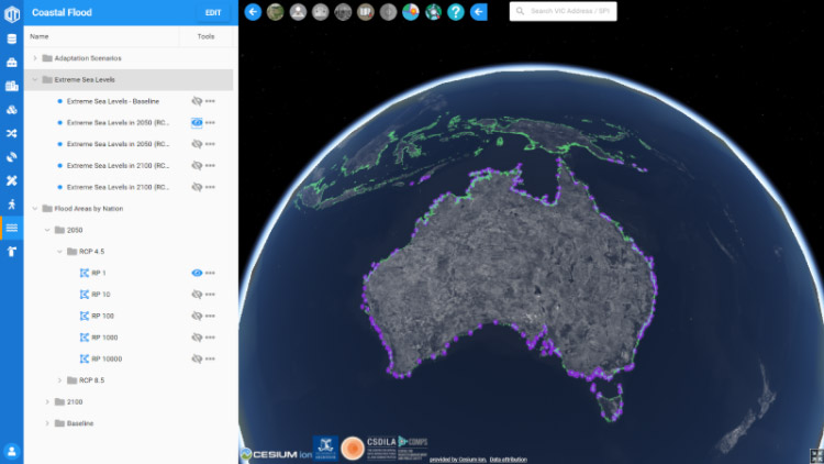
In October 2020, Ebru Kirezci and Ian Young from Ocean Engineering collaborated with us to introduce coastal flooding prediction and impacts at the coastal settings into Digital Twin. The coastal flood platform is a data visualiser and distributer to share with those interested in visualising the coastal flood impacts both globally and regionally.
The dataset presented in this module is an improved version of the data from Kirezci et al (2020). At the global extent, this dataset consists of extreme sea levels (ESLs) at more 9,800 coastal locations under various return periods, and the coastal flooding extents corresponding to these ESLs at the present conditions (baseline), by 2050 and 2100. The ESLs are projected into the future by using intermediate (RCP4.5) and high-end (RCP8.5) sea level rise scenarios from values of IPCC-Special Report on the Ocean and Cryosphere in a Changing Climate. Relatedly, based on three different coastal adaptation scenarios, the ‘Expected Annual People Affected’ and the ‘Expected Annual Damage’ are demonstrated at the country scale. The visualisation of this data has a crucial role for the public understanding of the coastal extremes and flooding impacts for the present conditions and planning for the future.
Digital Twin has the modular capabilities of data visualiser and data distributer and can be integrated to different data panels. Therefore, we designed the coastal flood platform as a data container to host the data set from Ebru Kirezci.
Capabilities
The current capabilities include:
- Data hosting
- Online data visualisation
- Metadata management and editing
- Data filter and query
- Data download