Melbourne Climate Futures Climate Research Accelerator Project
Find out about our strategic and major research projects
Integrating Wurundjeri Woi-wurrung feedback on digital design technology and mapping to inform near, mid and long-term scenarios for The Great Birrarung Parklands
2023
Project Leads: Alexander J. Felson, Kirstine Wallis
Rights Holders: Wurundjeri Woi-wurrung Cultural Heritage Aboriginal Corporation (WWCHAC)
WWCHAC Education Team: Consultation with Uncle Dave Wandin, Uncle Bill Nicholson,
facilitated by Katrina Larkham.
Collaboration with D-LAB, Centre for Spatial Data Infrastructures and Land Administration (CSDILA):
A/Prof Alice Kesminas, Davood Shojaei, Marko Radanovic, Maz Ghasemi and A/Prof Jagannath Aryal
Urban Ecology and Design Lab, Landscape Architecture Program, University of Melbourne.
Research Assistants: Claire Martin, Maria Bulmaga.
Overview
This project contributes to the University of Melbourne’s Design with Country initiative (studio and consultancy) and focuses on resiliency planning for the Great Birrarung Parkland. To provide context, in early 2021, the Birrarung Council – the voice of the Yarra River – invited postgraduate landscape architecture students from three universities to collaborate and develop a vision for the Great Birrarung Parkland. They asked for regeneration ideas from Naarm, the Birrarung murron (Yarra River Protection Act of 2017), Legislation that defines the river as a living entity.
In response, the Melbourne School of Design created the Design with Country: Resilience Studio, comprising urban designers and landscape and built-form architects, to explore the large, urbanised riverine system and develop and visualise design interventions for present to future scenarios. This multi-disciplinary studio brings together Aboriginal perspectives, heritage and Country living systems with contemporary urbanisation and Birrarung catchment management. We have established a co-educational course working with the Wurundjeri Woi Wurrung Cultural Heritage Aboriginal Corporation (WWCHAC) on envisioning the Birrarung (Yarra River) as a living entity and shaping the future vision. Led by UoM staff, including First Nations teachers and guests, students are immersed in local culture and science to navigate the concepts of connection to Country, building cultural awareness and engaging bi-culturally with Traditional Owners and knowledge holders, city managers, stakeholders and design professionals in order to understand the challenges and opportunities of the river precinct and surrounding areas from multiple perspectives and future scenarios.
Working with Data, Technology + the Digital Twin
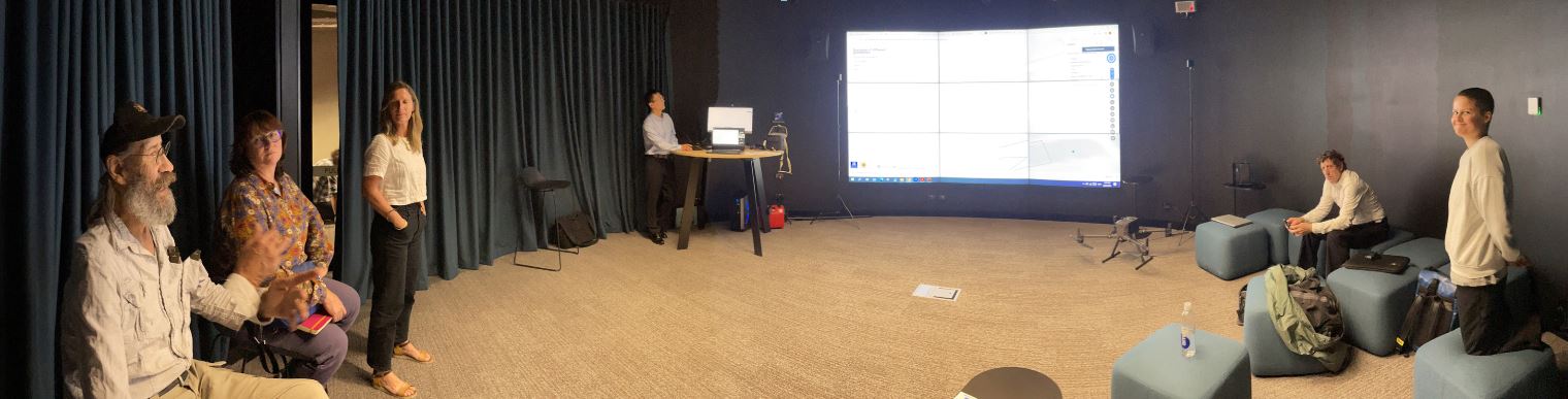
MCF’s CRX funding has supported workshops and research support for staff members to Walk on Country with Traditional Owners from the WWCHAC Education Group, to share the technology capabilities and data (capture, visualisation, and analysis) and showcase the digital technology workshop at CSDILA’s D-Lab to the Wurundjeri elder Uncle Dave Wandin and Uncle Bill Nicholson and to establish a location at a confluence along the Birrarung to target for further analysis and documentation.
This process supports the Design with Country/ Urban Ecology and Design Lab’s broader goal of developing data and climate visualisation strategies to sensitively organise and foreground Indigenous knowledge that informs the designs and to feed into planning for the Great Birrarung Parkland. This includes working with students as research assistants to focus on tributaries and cultural meaning, as well as drainage and infrastructure systems, and biology, with the goal of developing multi-scale culturally-guided resilience strategies based on climate change impacts modelled for 2050s and 2100s scenarios along the Birrarung and its tributaries. The working group, which spanned representatives from various UniMelb faculties, discussed and explored the application of Indigenous knowledge on urban and ecological planning and how this may utilise digital technology as a proactive influence on planning and design.. The Drone footage was arranged and completed on-site.
Digital Twin Application
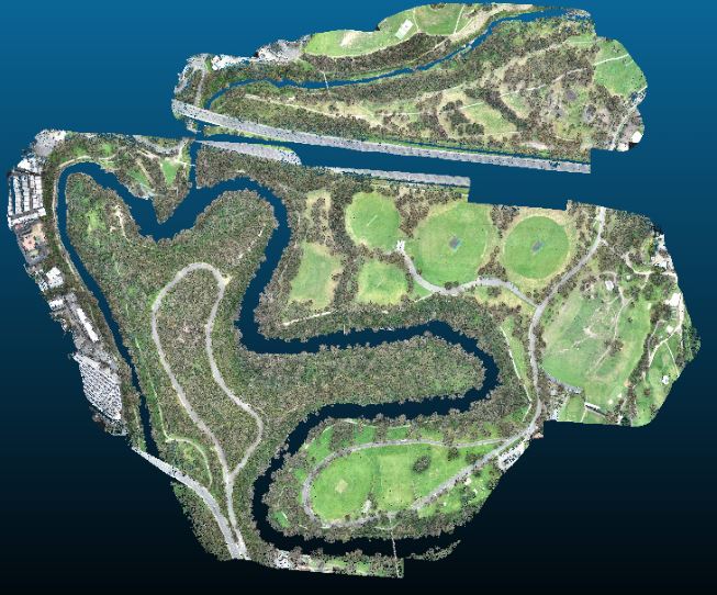
In 2023, D-Lab created a digital twin of the Birrarung (Yarra River) confluences within Melbourne’s Yarra Bend park for the Aboriginal heritage design and planning studio Design with Country: Resilience Studio, led by the Melbourne School of Design and the Wurrundjeri Woi-wurrung Education Group. This studio focuses on developing landscape architecture, infrastructure planning, and urban design strategies along the Birrarung through a multidisciplinary approach that incorporates indigenous knowledge and heritage, aiming to address resiliency and adaptation along the riverine corridor in collaboration with traditional owners, city managers, and professionals, aligning with the Yarra Development strategy plan and Melbourne Design Week.
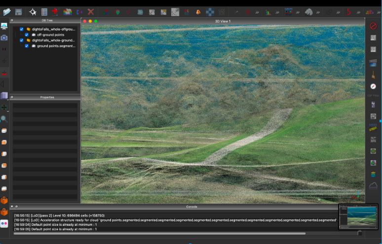
The D-Lab was tasked with creating multiple high-accuracy three-dimensional models of the area to be used by designers and researchers of the studio. The D-Lab processed airborne LiDAR (Light Detection and Ranging) data, extracted the topographic model of the bare Earth to create a Digital Terrain Model, and delivered models in multiple resolutions, from lighter and easier to visualise to denser and higher visual fidelity models. With the support of CSDILA, we successfully coordinated a professional pilot from XM2 to conduct a drone mission lasting approximately 6 hours. All necessary permits and legal requirements were duly fulfilled and approved before the flight day. The mission achieved its objective of capturing the required data. The RAW data has been processed, and trees have been separated from the landscape to improve ground plane analysis capabilities.