Our history
Featured content
Our beginnings in 2001
The following article appeared in the 26 November 2001 edition of UNI-NEWS and announced the establishment of the centre.
The University of Melbourne will receive $1.3 million in State Government funding to set up a research centre that will handle data with the potential to help combat environmental degradation, aid urban and regional planning, or even find a handy Thai restaurant. The new Centre for Spatial Data Infrastructures and Land Administration will be located in the University’s Department of Geomatics. Research in the Centre will drive the evolving concept of Spatial Data Infrastructures (SDI) — a global vision of virtual information systems that integrate and make accessible data that underpins the fabric of modern communities. The establishment of the new Centre is part of the extension of an existing research agreement between Land Victoria and the University of Melbourne. Victorian Minister for Environment and Conservation, Ms Sheryl Garbutt, announced funding for the new centre recently before opening an International Symposium on SDI, sponsored by Land Victoria, the Department of Natural Resources and the Environment, Victoria, and organised by the Department of Geomatics. The symposium brought together key international experts to consider the issues facing the development of a globally compatible and workable SDI that extends from local government, through state, national and regional jurisdictions. Head of the University’s Department of Geomatics and Director of the new Centre, Professor Ian Williamson, describes SDIs as underpinning the relationship and management of humankind to land. SDIs provide spatial information to support the systems that allow modern societies to operate, and they allow both the natural and built environment to be modelled and understood,
he says.
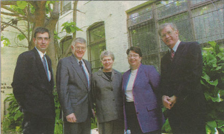
Global vision: At the opening of the new Centre for Spatial Data Infrastructures and Land Administration (from left) Director, Land Information Group, Land Victoria and Honorary Principal Fellow in the Department of Geomatics, Mr Steve Jacoby; Director of the new Centre, Professor Ian Williamson; Executive Director, Land Victoria, Ms Elizabeth O’Keeffe; Minister for Environment and Conservation, Ms Sherryl Garbutt; and the Vice-Chancellor, Professor Alan Gilbert.
The new centre will help Australia capture a greater share of a booming $34 billion global market, which is growing at 20 percent a year. It will act as a focus for research in SDIs and land administration and will encourage collaborative research projects with State and Federal governments in Australia, the private sector and leading overseas universities. In the past, we used maps to try and find where people and objects were. Today, this has evolved into a complex digital environment with sophisticated spatial and related textual databases, satellite positioning and communications networks like the internet and Wireless Application Protocol (WAP),
he says. A properly functioning SDI allows all this information to be integrated and accessible. Developing an SDI can facilitate things like environmental management, planning and construction of infrastructure — even developing your own business or property can become more cost-efficient and effective. For example, emergency services like ambulance and the fire brigade will become more efficient as locations of houses, roads, and distances to these locations are able to be represented and measured visually and digitally more accurately using the tools available in our everyday lives, not only across Victoria but across Australia. In urban environments, traffic conditions on major roads will be a mouse click away to enable the choice of optimum routes to and from emergencies. A future global vision is to facilitate the concept of ‘Digital Earth’ proposed by former Vice President of the USA, Al Gore.
Professor Williamson says the new Centre for Spatial Data Infrastructures and Land Administration will work closely with the Victorian Government in pursuing a similar vision to ensure that all Victorians have access to the spatial data they require to support their everyday lives and more broadly to ensure economic development and environmental sustainability.