2018 news
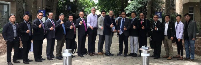
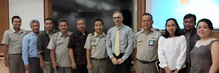
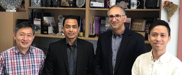
Indonesian Government Visit
19 December
Yesterday CSDILA was delighted to host a high-level delegation from the Indonesian Ministry of Agrarian Affairs and Spatial Planning and National Land Agency. This is the second group of delegates that have visited us regarding the modernisation of land administration systems.
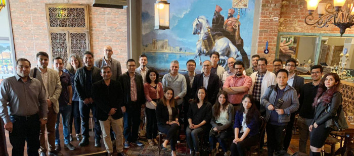
CSDILA and CDMPS Christmas Lunch
14 December
With its own challenges, 2018 was a successful year for Centre for SDIs and Land Administration (CSDILA) as well as Centre for Disaster Management and Public Safety (CDMPS). On 14 December, we have gathered in a Christmas lunch to celebrate the achievements of both research centres during the year 2018.
United Nations World Geospatial Information Congress
7 November
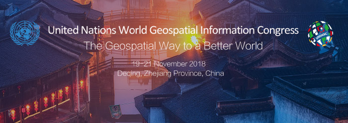
Our Director, Prof Abbas Rajabifard will be chairing and presenting a session at the inaugural United Nations World Geospatial Information Congress (UNWGIC), as the Chair of the Academic Network for the UN Committee of Experts on Global Geospatial Information Management.
The UNWGIC will be held in Dequing, Zhejiang Province, China from 19–21 November 2018, with an overarching theme The Geospatial Way to a Better World. It promises to be a global event that brings together stakeholders to address and ensure that geospatial information has its widest and fullest utility in service of social, economic and environmental development. The aim of the Congress is to provide a convening, participatory and inclusive environment to enhance the communication, understanding, knowledge and application of geospatial information management to address local, regional and global challenges.
Prof Rajabifard will chair a session on the theme of A Sustainable and Resilient World: Capacity Building and Geospatial Research for Implementing the SDGs.
Successful UNWGIC and visit to Wuhan University
21 November
On the 21 November, Professor Abbas Rajabifard chaired and concluded a successful session at the first United Nations World Geospatial Information Congress (UNWGIC) in China on the theme of A Sustainable and Resilient World: Capacity Building and Geospatial Research for Implementing the SDGs. This session was organised by the UN-GGIM Academic Network, which is chaired by Prof Rajabifard. During the session, Prof Rajabifard shared our recent work A Blueprint for Disaster Management RD&D Supporting the SDGs as a framework that establishes the detailed relationships between disaster management and the SDGs to guide future research, policy, and innovation for sustainable development and disaster risk reduction.
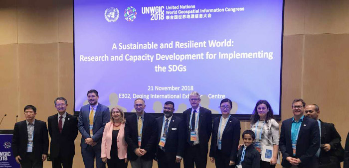
Following the UNWGIC, Prof Rajabifard will visit the State Key Laboratory of Information in Surveying, Mapping and Remote Sensing (LIESMARS) at Wuhan University on 24 November to give a talk on Enabling Business and Community: Resilience, 3D Land and Property, Urban Analytics.
United Nations World Geospatial Information Congress
7 November
Our Director, Prof Abbas Rajabifard will be chairing and presenting a session at the inaugural United Nations World Geospatial Information Congress (UNWGIC), as the Chair of the Academic Network for the UN Committee of Experts on Global Geospatial Information Management.
The UNWGIC will be held in Dequing, Zhejiang Province, China from 19–21 November 2018, with an overarching theme The Geospatial Way to a Better World. It promises to be a global event that brings together stakeholders to address and ensure that geospatial information has its widest and fullest utility in service of social, economic and environmental development. The aim of the Congress is to provide a convening, participatory and inclusive environment to enhance the communication, understanding, knowledge and application of geospatial information management to address local, regional and global challenges.
Prof Rajabifard will chair a session on the theme of A Sustainable and Resilient World: Capacity Building and Geospatial Research for Implementing the SDGs.
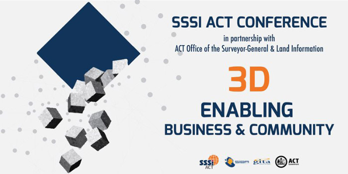
SSSI ACT Conference: 3D Enabling Business and Community
2 November
On the 2 November 2018, our Director, Prof Abbas Rajabifard, was in Canberra for the SSSI ACT Conference. This year the conference focussed on the theme of ‘3D Enabling Business and Community’.
Prof Rajabifard gave a talk on ‘Urban Analytics and 3D’ and was an invited panellist on the discussion of ‘Challenges and Opportunities in 3D’.
View the full event program [PDF]
46th International Registrar of Titles Conference
1 November
On 1 November 2018, our Director, Prof Abbas Rajabifard, was in Canberra for the 46th International Registrar of Titles Conference. This annual event is attended by Registrars of Titles and senior staff from Torrens based land registries around the world.
The 2018 conference was hosted by the Australian Registrars National Electronic Conveyancing Council (ARNECC) on the theme of “Leading the Property Transaction Revolution”.
Prof Rajabifard was invited to discuss a work recently released from CSDILA titled ‘Research and Current Practice in 3D Digital Cadastre in Australia’.
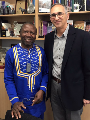
Visit From Dr Dozi Ezigbalike
12 October
We were pleased to welcome Dr Dozi Ezigbalike, former UN Economic Commission Africa, who visited us this week to discuss potential areas for collaboration.
A Successful Symposium!
4 October
We are pleased to announce the success of the international symposium and workshops, A Smart Sustainable Future for All – Enhancing Resilience in a Changing Landscape (SSF 2018), from 24–26 September 2018 at the University of Melbourne.
Our event was co-hosted by the Centre for Disaster Management and Public Safety, in co-partnership with the World Bank Global Facility for Disaster Reduction and Recovery, and the Social, Urban, Rural and Resilience Global Practice), and supported by a number of national and international organisations.
The Symposium hosted over 150 national and international speakers, including a variety of experts and representatives from academia, government and industry. The symposium created an ideal environment for informed discussion and for promoting a collaborative effort towards a smart sustainable future for all.
As part of the event we were pleased to host two workshops, the first was led by CSDILA, with speakers from the Centre and Land Use Victoria, on ‘Smart Land and Urban Data Management’. The second was presented by Bob Jensen, an expert in disaster management from the USA and Senior Managing Director of Strat3 on ‘Leadership During Crisis and Developing Next Generation Emergency Management Teams’. Both workshops were well received and we are grateful to those who contributed to ensuring their success.
In addition, we hosted a free ePlan workshop in collaboration with Land Use Victoria (LUV), Department of Environment, Land, Water and Planning (DELWP), on the current and future developments of ePlan in Victoria. CSDILA are currently partnered with LUV to modernise the land subdivision process as part of the ePlan initiative. We welcomed presenters from LUV, including Mark Briffa, Manager of Electronic Subdivisions Unit; Dr Hamed Olfat, ePlan Coordinator; and Craig Sandy, Surveyor General We also welcomed Tom Champion, Associate Director of Reeds Consulting, and members from the surveying industry. This was an excellent workshop that received a lot of positive feedback. Thank you to LUV for their support and contributions to this event.
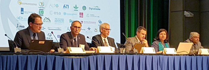
On the third anniversary of the United Nations Sustainable Development Goals (SDGs), we launched the Blueprint for Disaster Management Supporting the SDGs, where senior executives, including Anna Wellenstein, Director of Strategy and Operations, the World Bank; Mark Crosweller, Head of the National Resilience Taskforce, Department of Home Affairs, Australian Government; and Assistant Commissioner Debra Abbott, Victoria Police, commented on the significance of the research.
CDMPS and CSDILA will continue the discussion on sustainability and smart cities and hope that this event was a step toward building a smart sustainable future for all. We hope that you will join our collaborative effort towards achieving this goal.
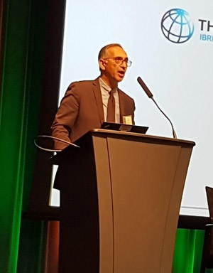
Blueprint Launch at SSF2018
2 October
In collaboration with our sister institute, the Centre for Disaster Management and Public Safety , successfully launched A Blueprint for Disaster Management RD&D Supporting the Sustainable Development Goals at the international symposium A Smart Sustainable Future for All on 25 September 2018 the third anniversary of the United Nations Sustainable Development Goals.
The Blueprint provides analysis and a research framework to support policymakers, first responders, industry stakeholders and community members strengthen our resilience to future disasters. The path to a sustainable and resilient future is paved by the decisions we make today, and our work seeks to support positive evidence-based action.
Senior executives from major government and international organisations attended the launch and commented on the significance of the research, including: Anna Wellenstein, Director of Strategy and Operations, the World Bank Mark Crosweller, National Resilience Taskforce, Department of Home Affairs, Australian Government; and Assistant Commissioner Debra Abbott, Victoria Police.
About the blueprint, Anna Wellenstein said, "I was really excited to learn about the blueprint. I think unless we really know what progress we’re making, and we have targets – it’s hard for us to learn from each other – one country to the next – about what’s a really effective policy and program and what’s not, and it’s really hard to see if we’re on the right track or not… It’s quite an accomplishment that the team here at the University of Melbourne was able to put together a plan and I look forward to its discussions with a lot of the countries and international agencies."
We hope this roadmap will encourage further discussion, collaboration and research towards a smart and sustainable future.
If you would like to support or collaborate with us in implementing the Blueprint – please contact CDMPS at cdmps-info@unimelb.edu.au
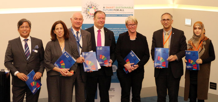
Caption: (From left to right) Prof Greg Foliente (Deputy Director, CDMPS), Anna Wellenstein (Director, Strategy and Operations, the World Bank), Hon Gary Nairn (Former Spatial Minister, Australia), Mark Crosweller AFSM (Head, National Resilience Taskforce, Australian Government Dept of Home Affairs), Assistant Commissioner Debra Abbott (Victoria Police), Prof Abbas Rajabifard (Director, CDMPS and CSDILA, University of Melbourne), Maryam Rabiee (Research Associate, CDMPS and CSDILA)
ISV 2018 Surveying Expo
30 September
Our collaborator, the Institution of Surveyors Victoria (ISV), recently held their 2018 Surveying Expo in Melbourne, Victoria. This event welcomed about 200 delegates from Australian Universities and the surveying industry.
CSDILA’s Deputy Director, Dr Mohsen Kalantari, attended the event and was also invited to be a member of a panel for a discussion on smart cities. The main message gained from this discussion was that surveyors need to expand their frontiers further than ’cadastral’ in order to secure their businesses. A note-worthy quote was the Singapore motto; ’Limited land, Unlimited space’.
Prof Rajabifard’s keynote speech at Tasmanian Surveying & Spatial Conference
14 September
Professor Abbas Rajabifard delivered an opening keynote talk at the Tasmanian Surveying and Spatial Conference (TSSC) on 14 September. His presentation reported on CSDILA’s ARC Linkage Project: ‘3D Property Ownership Map Base for Smart Urban Land Administration’. In his speech, Prof Rajabifard presented solutions for accommodating 3D data derived from regulatory urban subdivision processes into the current 2D property ownership map base. Prof Rajabifard highlighted the importance of transforming 2D property maps into a 3D digital information environment.The theme of TSSC was ‘Positioning Property People Now’, which drove conversation towards the new positioning paradigm, in particular the opportunities presented by the NPI announcements, and the convergence with the modernisation of digital cadastres and what this all means.
Disaster Management and Resilience workshop in Indonesia
12 September
Prof Rajabifard conducted a workshop in Jakarta, Indonesia on the topic of Disaster Management and Resilience and Resilience Impact of Land and Geospatial Information. This workshop is conducted in close collaboration with World Bank. The workshop was part of the collaboration with the World Bank on the project: Improving Resilience and Resilience Impact of National Land and Geospatial Systems.
CSDILA hosts Victorian 3D Digital Cadastre Roadmap workshop
31 August
CSDILA was delighted to host Land Use Victoria and Prof Jantien Stoter from Delft University of Technology on Thursday 30th August for a workshop about the Victoria 3D Digital Cadastre Roadmap. Land Use Victoria is currently working towards a 3D Digital Cadastre for the State, and we are proud to be consultative partner for this project.We had a rich discussion about the project’s vision: how to align with ICSM Cadastre 2034, and the importance of transitioning to a 3D digital cadastre to enable the 3D built environment. Outcomes from the meeting were, as follows:
- A plan for transitioning from the current 2D cadastre to a 3D digital cadastre.
- Identification of critical relationships between the data lifecycle, regulations and stakeholders.
- Indicators of progress for a change strategy.
It was wonderful to have input from Prof Jantien Stoter, who is currently working on a similar roadmap in the Netherlands – her valuable contribution was greatly appreciated. We look forward to continuing this important work with Land Use Victoria.
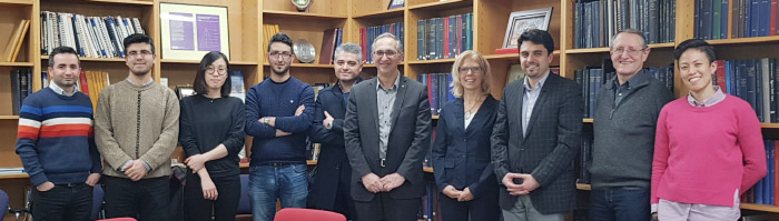
Prof Jantien Stoter visited CSDILA
28 August
We are pleased to welcome Professor Jantien Stoter who is visiting us from the Delft University of Technology this week to discuss potential areas for research collaboration in 3D spatial information domain. Jantien Stoter is a full professor in Spatial Data Infrastructure, at the Faculty of Architecture and The Built Environment, Delft University of Technology and she is leading the 3D GeoInformation group at the Department of Urbanism.
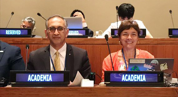
Eighth Session of the Committee of Experts on UN-GGIM
7 August
The United Nations – Global Geospatial Information Management (UN-GGIM) Academic Network Forum was held in the week from 1–3 August as part of the Eighth Session of the Committee of Experts on GGIM at UN Headquarters, New York.
The theme of the event was The SDGs Connectivity Dilemma: Urban Settlements, Resilience, and Sustainability and brought together over 100 delegates and geospatial experts and academics from over 50 Member States, academic institutions, and the private sector.
In his opening remarks, our Director Prof Abbas Rajabifard, as Chair of the UN-GGIM Academic Network, addressed the theme of the event, particularly in the areas of sustainability, resilience, and connectivity for urban communities and settlements. Read more about the Forum [PDF]
CDMPS and CSDILA are also working along this same theme and looking at these connections in the context of Infrastructure and Community Resilience, spatial technologies and policy implications
Our Research Associate Maryam Rabiee also presented at the forum on the topic of Mapping SDG Interactions for Cities. Her presentation was a small piece of a larger project she is working on with CDMPS and CSDILA: A Blueprint for Disaster Management RD&D Supporting the Sustainable Development Goals. Find out more
During the academic network report to the Eighth Session of the Committee of Experts on UN-GGIM, Professor Abbas Rajabifard announced that the Blueprint will be launched at our international symposium on A Smart Sustainable Future for All: Enhancing Resilience in a Changing Landscape in September 2018.
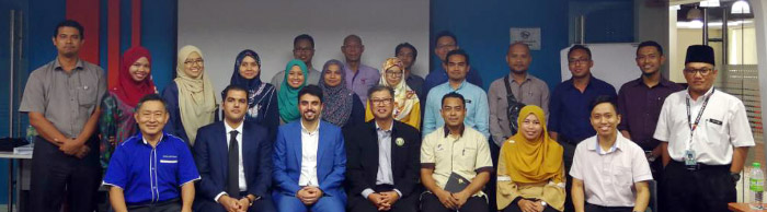
Visit: Malaysia 3D Cadastre
1 June
We recently hosted representatives from our Malaysian project partners to discuss our progress on developing prototype tools for 3D cadastre for Malaysia.
At CSDILA recently hosted representatives from the Department of Survey and Mapping Malaysia (JUPEM) and ENVIRO Land Services.
This visit, from May 30–31, was an opportunity for us to showcase our work on the exciting project Malaysian 3D Cadastre. Currently, legal information about land – known as a cadastre – is largely stored in 2D databases, but as our cities grow in all directions there is a need for frameworks to encompass air space and the underground.
This project includes a study of requirements and developing new tools to support this transition, as we migrate 2D data into an open source database and build applications to create a 3D cadastral system.Our client JUPEM came to see our work in person and discuss our design for a prototype, which includes a series of applications including server, database and desktop application, to implement the 3D cadastre – putting theory into practice.
This project will continue over the following months, through three phases, with the goal to complete work in September. Our thanks to JUPEM and ENVIRO Land Services for their visit and supporting us to do this important and innovative work.
Prof Rajabifard’s Invited Speech in FIG Congress 2018
10 May
Prof Abbas Rajabifard presented our recent peer-reviewed paper in the topic of 3D Digital Cadastre in XXVI FIG International Congress & General Assembly 2018 in Istanbul, Turkey.
This work was part of CSDILA’s ARC Linkage Project ‘3D Property Ownership Map Base for Smart Urban Land Administration’. This project is supported by Land Use Victoria, Intergovernmental Committee on Surveying and Mapping (ICSM), and City of Melbourne.
View the published version of the paper [PDF]
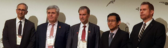
FIG Congress 2018
26 April
Prof Abbas Rajabifard will be a plenary speaker at the FIG Congress 2018 in Istanbul, Turkey.
FIG Congress brings together the international community of surveying and spatial professionals together. Scientists, experts, policy and decision-makers, students, and stakeholders are invited to join the discussions on issues affecting the international surveying and spatial community today and in the future. The theme this year is Enhancing our smart world where the continents connect: enhancing the geospatial maturity of societies.
Prof Rajabifard’s session will be on Spatially Enabled Societies and Smart Communities.
Find out more about FIG Congress 2018.

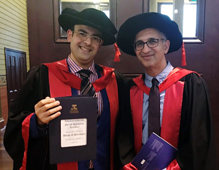
Graduation: Dr Farzad Alamdara
10 April
Congratulations to Dr Farzad Alamdara on receiving his Doctorate degree on Tuesday 10 April at the University of Melbourne.
Research Title: Supporting Disaster Management Utilising Multi-Agency Sensor Information Supervisors: Dr Mohsen Kalantari & Prof Abbas Rajabifard
During his PhD, Farzad was involved in a multi-national Geospatial project to support Incident Management Information Sharing (IMIS) using Internet of Things (IoT), in conjunction with the Department of Homeland Security (DHS) and Open Geospatial Consortium (OGC). The focus of his work in the OGC IMIS IoT pilot was the development of OGC Web Processing Services (WPS) for real-time processing of sensor data to serve incident management tasks.His research has led to several peer-reviewed journal and conference publications.
Farzad is a GIS specialist, geospatial web service developer, and Internet of Things (IoT) researcher.
Currently, Farzad is working as a senior GIS data analyst in the IoT company; ‘Intelliscape’ and he is expanding his knowledge and experience in the IoT industry.
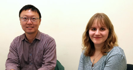
Visit from Professor Josef Strobl
9 April
We were pleased to welcome Professor Josef Strobl who visited us from the University of Salzburg this week to discuss potentials for collaboration.
Professor Josef Strobl is Head of the Department of GeoInformatics at the University of Salzburg, Austria. Professor Abbas Rajabifard was pleased to receive a visit from Professor Strobl this week to discuss what research areas CSDILA and CDMPS could more closely collaborate on with the University of Salzburg.
We are currently hosting PhD candidate Laura Knoth at CSDILA, who is visiting from the University of Salzburg. Laura is investigating 3D Urban Land Administration and BIM as part of this collaboration.
CSDILA will be presenting at LADM Workshop on 12 April
6 April
As part of our 3D cadastre project for Malaysia, CSDILA will be presenting the paper titled An LADM-based approach to developing and implementing national 3D cadastre: A case study of Malaysia [PDF] in LADM2018: The 7th Land Administration Domain Model Workshop in Zagreb, Croatia on 12 April.
Annual World Bank Conference 2018
22 March
We are delighted to collaborate with the World Bank on the project:Improving Resilience and Resilience Impact of National Land and Geospatial Systems. Last week, our joint research team, led an international expert meeting and a plenary panel on this topic at the World Bank Annual Land and Poverty conference in Washington.
The meetings focused on the scope and initial findings of our collaborative project with the World Bank, on the same topic. The event offered the opportunity for us to present our inception report outlining relevant literature and a best practices analysis. We also interacted with the country consultants engaged on the project, including India, Nicaragua, Nigeria, Norway and Turkey, who provided their preliminary findings and insight from their country contexts. The event provided a chance to carry out an in-depth discussion with many key international organisations.
The event was a great success and was well attended by representatives hailing from countries such as Finland, Norway, Uganda, Nigeria, Nicaragua, Netherlands, UK, Peru, Moldova, Slovenia, Greece. Representatives also attended from a number of sectors of the World Bank, including the Land Sector, Disaster Risk Management Sector, and the Global Facility for Disaster Reduction and Recovery Unit, who participated in the discussion and offered keen observations and input into the project.
Following the expert meeting, our team participated in a Round table discussion event with high level members of the World Bank to gain further insight into the important themes and issues surrounding our project topic. We were given a chance to present in a panel session during the conference, which we used to present our project and findings, and to conduct an interactive panel discussion with attendees.
Our project is currently within the inception and case study stages but gaining momentum. We welcome any parties interested in joining this initiative to contact us for further information on how to become involved. Issues relevant to a variety of country contexts adds value and greater outcomes. As part of the project we will host an International Forum in Melbourne in September 2018, watch this space: www.ssf2018.com
CSDILA members visited Department of Survey and Mapping (JUPEM) in Malaysia
7 March
The Department of Survey and Mapping Malaysia (JUPEM) invited CSDILA to facilitate 3D cadastre and LADM workshop. The workshop was attended by representatives of JUPEM and their stakeholders. A number of representatives from governmental departments also participated to provide their input into CSDILA’s 3D cadastre and Land Administration projects. These governmenttal departments included the Department of Land and Mine, the Department of Planning, the Planning Department of City Council in Kuala Lumpur, the Department of Valuation, as well as the Property Services and Land Titling offices. During this visit CSDILA had the opportunity to discuss technical arrangements for the delivery of the new model for 3D cadastre in Malaysia. This workshop was led by Dr Mohsen Kalantari and Mr Mohsen Anaraki.
CSDILA welcomes Ms Laura Knoth from University of Salzburg, Austria
6 March
We welcome PhD candidate Laura Knoth, who is visiting us from the University of Salzburg, Austria. Laura is in the second year of her PhD and her research interests are in 3D building modelling, as well as building transformation and integration with other 3D spatial data to improve situational awareness. Laura will be with us for about 4 months to collaborate on some research related to 3D building models.
Professor Abbas Rajabifard gave a keynote speech at the 1st International BIM Conference hosted in Iran
26–27 February
Professor Abbas Rajabifard gave a keynote speech titled ’BIM and Smart Cities with Spatial Information Technologies and Urban Analytics’ at the International BIM Conference hosted in Iran. This is the first comprehensive international conference on ‘Building Information Modelling’ (BIM). The BIM approach is a relatively new concept in the design, construction and management of building projects that has been adopted by many first world countries. Construction laws in some of these countries have been refined by specific contracts that don’t allow construction without the use of this method. In Iran, leading companies have begun using BIM and offer their services to their clients with BIM quality; this topic was discussed at the conference. Find out more about the conference and its objectives.
Professor Rajabifard was also interviewed by Specialty Media at the conference (in Farsi).