2019 news
BIM & Modern Urban Land Administration training
15 November 2019
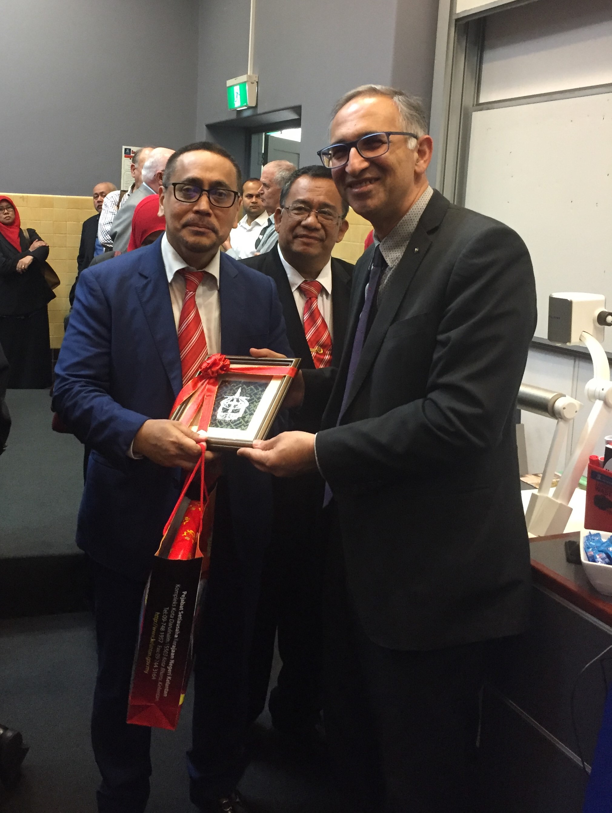
CSDILA proudly conducted an interactive and dynamic training program on BIM & Modern Urban Land Administration for a delegation from the Association of Authorised Land Surveyors Malaysia (PEJUTA). It was an absolute honour and privilege to host our Malaysian guests and colleagues.
Victoria’s first Spatial Digital Twin Launch
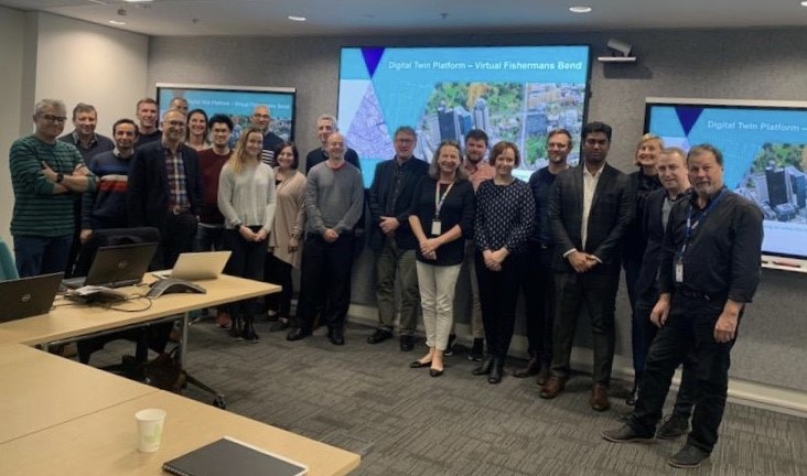
27 August 2019
In collaboration with the Department of Environment, Land, Water and Planning (DELWP), Victoria’s first Spatial Digital Twin will be launched on Friday 23 August, by the Minister for Planning Victoria at The University of Melbourne. Using state-of-the-art planning and mapping technologies, together with innovative 3D spatial data, the twin will be used to model and visualise Australia’s largest urban renewal project at Fishermans Bend, showcasing and examining the implications of future of our cities in a digital environment.
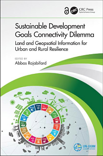
Sustainable Development Goals Connectivity Dilemma book
7 August 2019
We are delighted to announce the launch of a new book on Sustainable Development Goals Connectivity Dilemma: Land and Geospatial Information for Urban and Rural Resilience in the UN-GGIM meeting. This is an open access book and can be downloaded.
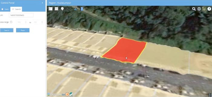
Malaysia’s first 3D digital cadastral database based on LADM standard
5 August 2019
CSDILA is pleased to announce the development of the first 3D National Digital Cadastral Database (3D-NDCDB) for Malaysia in line with the International Land Administration Domain Model (LADM) standard and Malaysian country profile.
Based on the developed national 3D-NDCDB, a prototype system was implemented with these features:
- Modular design: Every module can be used independently. This enables the Department of Survey and Mapping Malaysia (JUPEM) to use any of the modules based on their future direction for development of 3D-NDCDB.
- Modern application framework: The system architecture follows the modern application design using APIs and web technologies.
- Platform independent: The implemented prototype can be used on various operating systems and devices.
- Open source software and libraries: Except STAR*NET (height adjustment software) the rest of system is developed using open source software and libraries.
- Parallel process to 2D-NDCDB: 3D process does not interrupt the existing system and is parallel to existing practices.
More information about the 3D National Digital Cadastral Database project
Integrated data models for 3D digital cadastre
30 July 2019
Over the past decade, CSDILA has been working on integrating legal and physical dimensions of urban environments to develop a 3D Cadastral Data Model (3DCDM). This data model can be used for a wide range of 3D cadastral applications. 3DCDM enables the capture, storage, editing, querying, analysis and visualisation of 3D land rights, restrictions and responsibilities (RRRs) in cadastres. It is extensible and designed as an open data model, so that XML-based mark-up languages such as GML can be used to encode this data model.
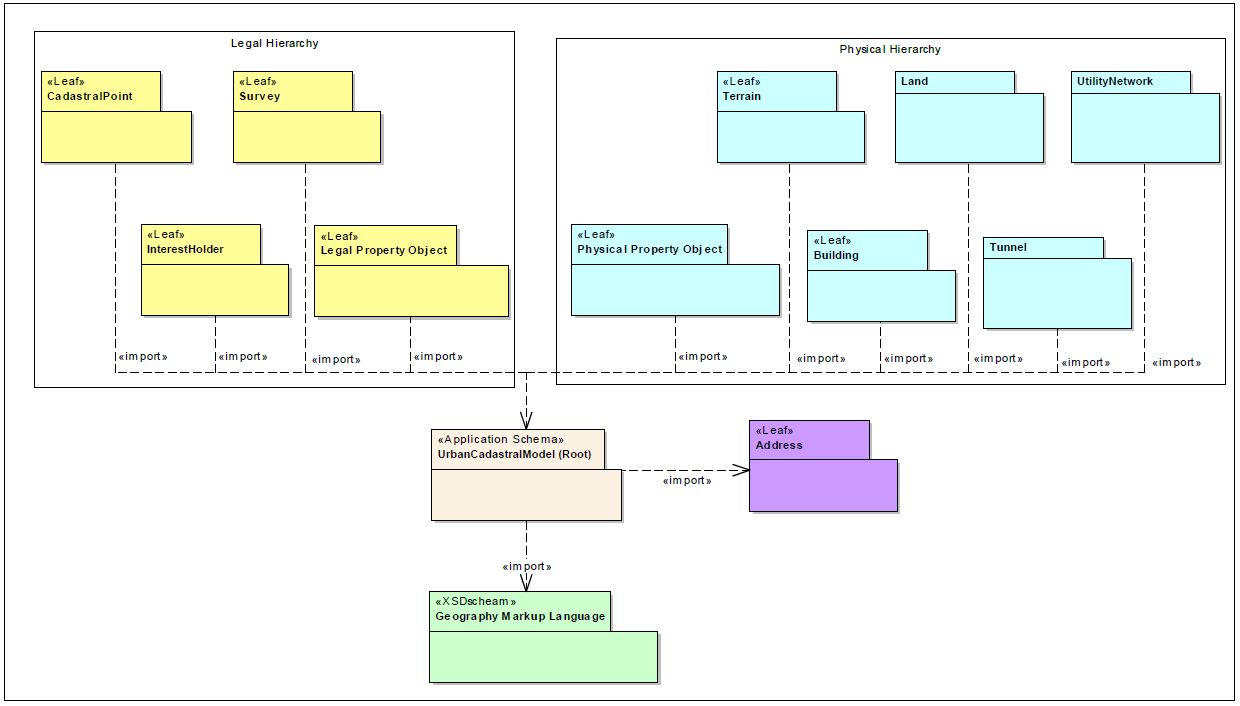
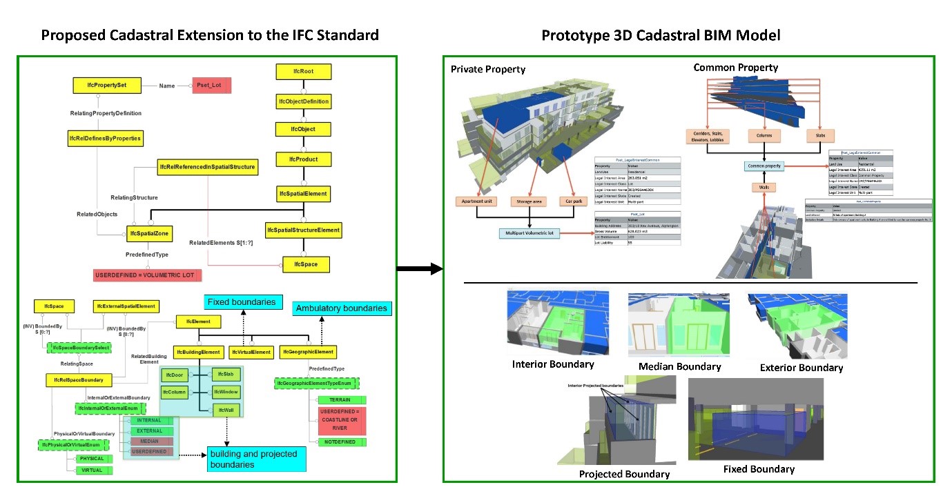
This work has been extended to support digital management of 3D data resulting from building subdivisions using Building Information Modelling (BIM). CSDILA has worked on enrichment of Industry Foundation Classes (IFC) to support 3D cadastral data management within the BIM environment. CSDILA’s main contribution has been extending the concept of spatial zones and space boundaries in IFC to lay the foundation for managing complex 3D cadastral spaces. A prototype model was implemented to emphasise the feasibility of the extended BIM-based data model for land administration and prove the effective visualisation and management of ownership rights in complex urban areas.
CSDILA is currently planning to develop an integrated BIM-GIS data model to support a fully integrated view of 3D cadastre in both indoor and outdoor environments. To this end, CSDILA is currently collaborating with BIM and GIS standard committees within Standards Australia to realise the 3D cadastre use case for a full integration of BIM and GIS.
For more details, please refer to this publication:
Development of ePlan Oracle Database
22 July 2019
CSDILA is pleased to announce the development of the world-first Oracle database for storing cadastral data in ePlan LandXML format on Amazon Web Services (AWS) cloud environment. The ePlan Oracle database has been developed through a collaborative program between Land Use Victoria and CSDILA aiming at modernising the land administration system in Victoria. This database extracts the cadastral plan and survey data from registered ePlan LandXML files and stores them in spatial database objects for digital cadastral data search, visualisation, download, analysis and reporting purposes.
The ePlan database has the potential to store proposed ePlans, Abstract of Field Records (AFR) in ePlan format, and ePlans back-captured in Digital Cadastre Modernisation (DCM) project. It also has the potential to be linked to ePlan Data Viewer to make the registered ePlans available to land subdivision stakeholders in Victoria.
Release of ePlan Visualisation Enhancement Tool (VET) version 3.1
15 July 2019
CSDILA is pleased to announce the release of ePlan Visualisation Enhancement Tool (VET) version 3.1. VET has been developed as part of a collaborative program between CSDILA and Land Use Victoria aiming at modernising the Victorian land administration system. VET allows the Victorian surveyors to enhance the PDF plan visualised from an ePlan LandXML file, using the following main functions:
- Adjust labels and arrows
- Create enlargement diagrams
- Define sheets
- Define exaggerations
- Adjust title connections.
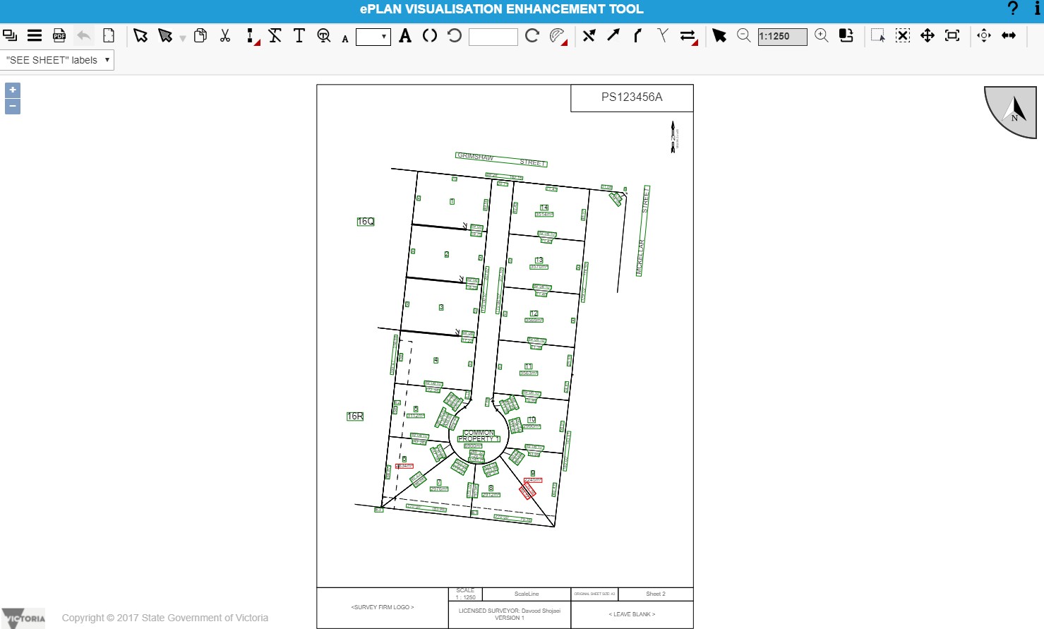
For further information, refer to SPEAR User Guide 57 (PDF).
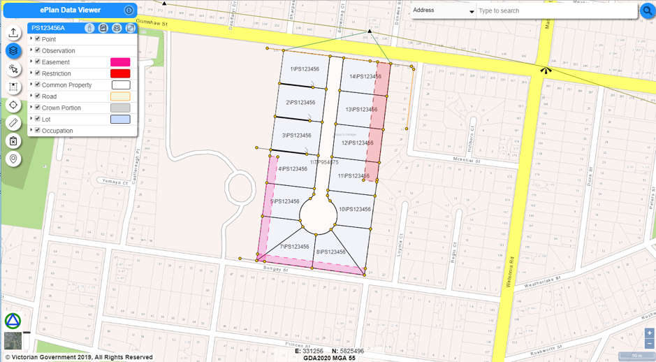
Launch of new ePlan Data Viewer
12 July 2019
CSDILA is pleased to announce the launch of a new ePlan Data Viewer based on the state-of-the-art technologies as part of a collaborative program between Land Use Victoria (DELWP) and CSDILA aiming at modernising the Victorian land administration system. This application allows surveyors and plan examiners to review the content of an ePlan LandXML file. Functions available include:
- Visualising ePlan layers over Vicmap layers
- Turning on/off ePlan layers
- Visualising ePlan textual information such as plan and Owners Corporation details
- Identifying ePlan features and Vicmap parcels
- Visualising and identifying survey marks from Survey Marks Enquiry Service (SMES)
- Measuring between points
- Searching based on parcel SPI and address
For further information on the functionality and how you can access the ePlan Data Viewer, refer to SPEAR User Guide 52 (PDF).
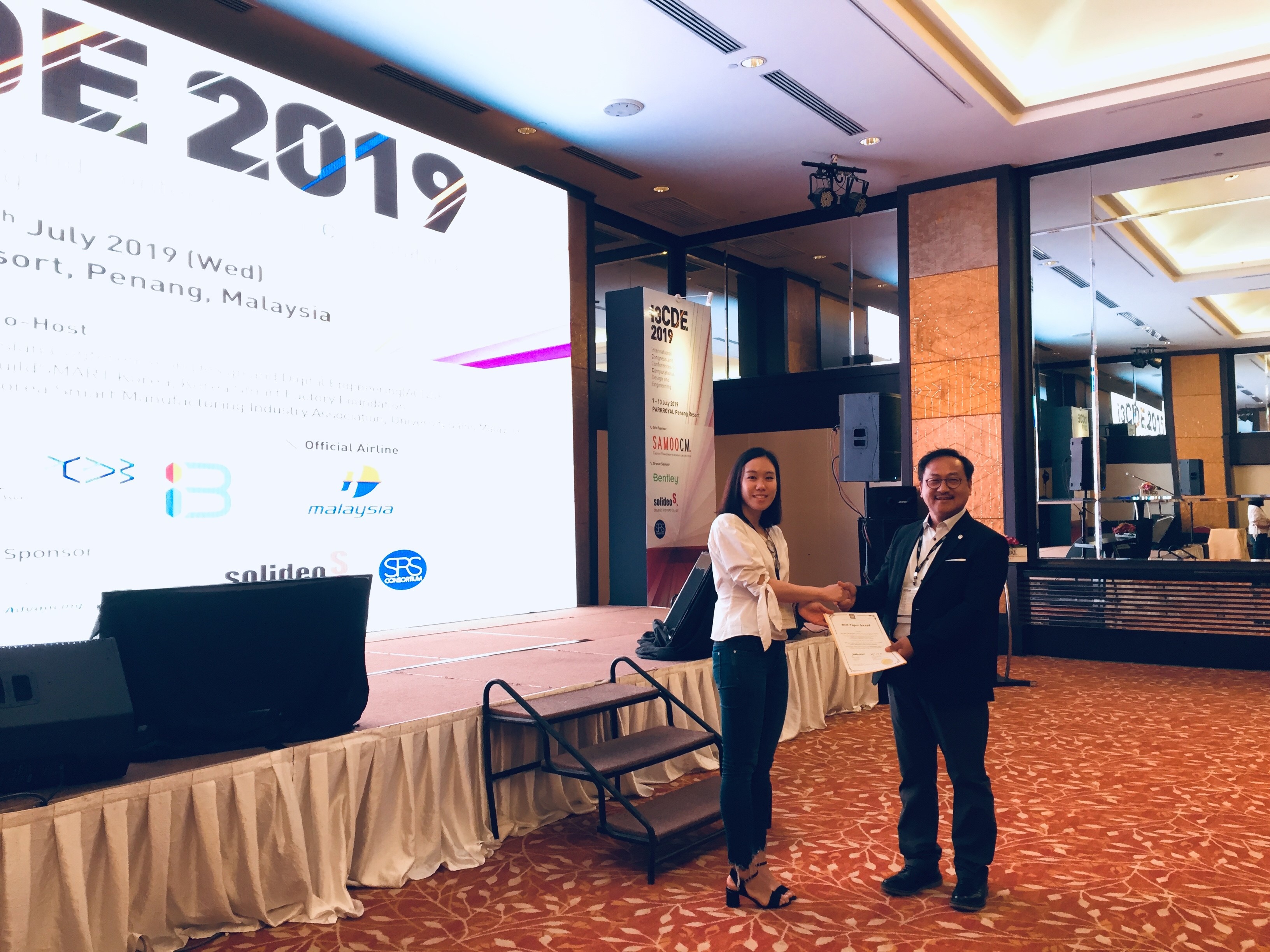
Best Paper Award at I3CDE 2019
10 July 2019
CSDILA congratulates our PhD candidate Jihye Shin on receiving the “Best Paper Award” at International Congress and Conferences on Computational Design and Engineering (I3CDE) 2019. She presented her paper titled “BIM-based Approach for Preaction Resolution of Disputes over Common property Management in Multi-owned Developments” at the conference which was held from 7–10 July in Penang, Malaysia.
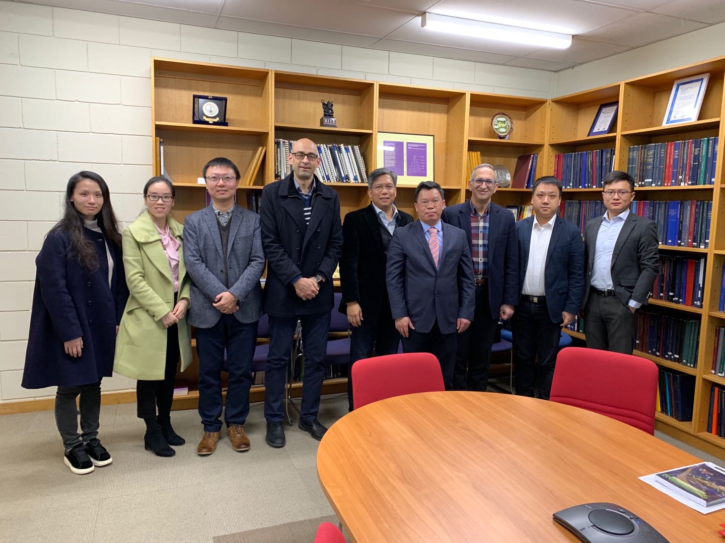
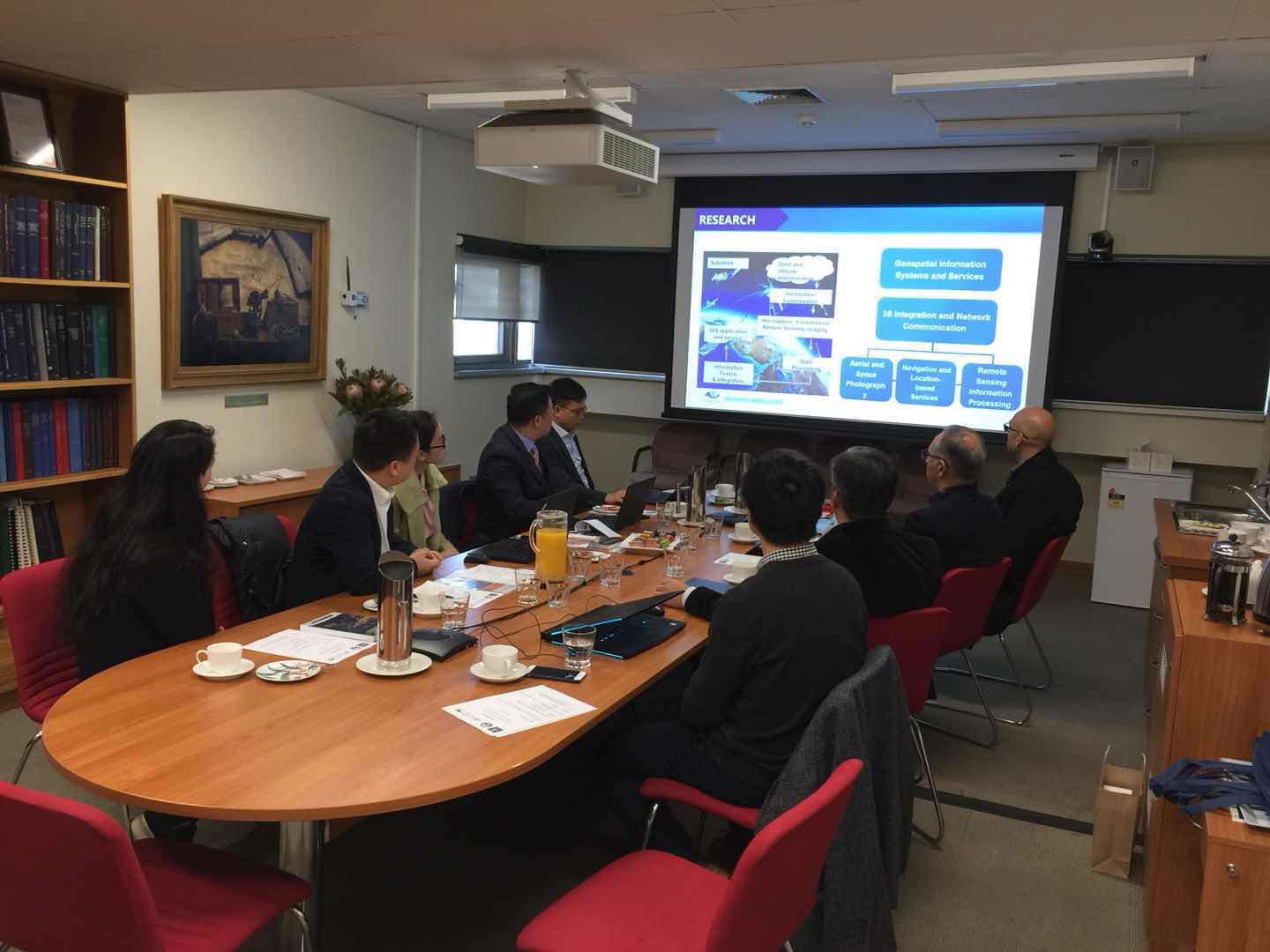
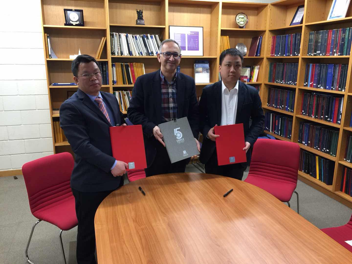
An exciting workshop to strengthen our relationship with the international research and innovation community
9 July 2019
Last week was an exciting one for the CSDILA family as we hosted an exciting workshop to strengthen our ongoing relationship with the international research and innovation community and to discuss collaboration and partnership opportunities covering joint research and development areas, students and academics exchanges, and partnership in the future events and grant applications. The workshop was attended by Prof Neng Cheng Chen, Dr Xiang Zhang and Dr Wenying Du from the State Key Laboratory of Information Engineering in Surveying, Mapping and Remote Sensing (LIESMARS), Wuhan University, China and Associate Prof Hao Sheng, from the School of Computer Science & Engineering at the Beihang University, China. During the workshop, CSDILA signed MOUs and hoped to establish a strong and sustained partnership with both parties.
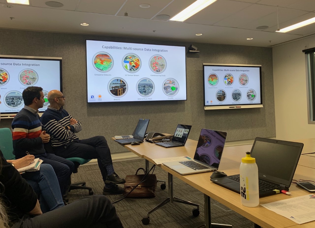
Fishermans Bend Digital Twin presentation
5 July 2019
Today our team has presented at the Victorian 3D Working Group, hosted by Land Use Victoria, DEWLP, the technical progress on the Victoria’s first Digital Twin for Fishermans Bend. The project has showcased the earlier capabilities of the best geospatial functionalities that Victoria has to offer and discussed a model of an innovative ecosystem that enhances Victoria’s liveability. We are very proud to be the lead for the design and development of the Fishermans Bend Digital Twin platform. Thanks to our talented technical team.
A presentation at the GI_Forum conference
5 July 2019
Our PhD candidate, Jihye Shin gave a presentation at the GI_Forum conference in Salzburg, Austria. This annual conference was hosted by the Z-GIS department of the University of Salzburg and Austrian Academy of Science. She introduced the current research in our centre regarding the conceptual model of a 3D spatial data framework for urban land and property management.
Prof Abbas Rajabifard awarded a University of Melbourne Sustainability Fellowship
14 June 2019
Professor Abbas Rajabifard, Director of CSDILA, has been selected as one of the University of Melbourne’s inaugural Sustainability Fellows and awarded a Sustainability Fellowship. These fellowships were established to catalyse the embedding of sustainability in the University curricula, enabling students to understand and apply sustainability knowledge and values to practice in their field of study.

Prof Rajabifard chairs ‘VGI and crowdsourcing’ session at FIG 2019
25 April 2019
Professor Abbas Rajabifard chairs a session on the Land Surveyors Role in the Era of Crowdsourcing and VGI at the FIG Working Week in the Vietnam National Convention Center in Hanoi, Vietnam. A new FIG Publication on New Trends in Geospatial Information is presented and formally launched in this session.
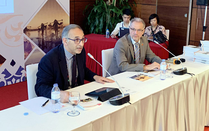
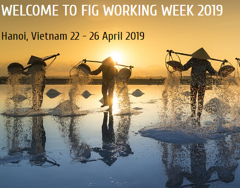
FIG Working Week 2019
18 April 2019
Professor Rajabifard, Dr Farhad Laylavi and Dr Daniel Paez will attend to FIG Working Week 2019 in Hanoi, Vietnam between 22–26 April 2019. Professor Rajabifard will present following topics:
- Strategic Pathways Towards Disaster Resilience-Leveraging National Land and Geospatial Systems, Wednesday, 24 April, 16:00–17:30.
- Land Administration Integration Framework for Affordable Housing Production: the Roles of Spatial Data Infrastructures, Institutional Processes and Policies, Tuesday 23 April, 14:00–15:30.
In addition, Dr Paez will present the following paper:
- A Proposed Methodology to Assess Disaster Risk within a Land Use Cover Change Model, Contributing to SDGs, Thursday 25 April, 11:00–12:30.
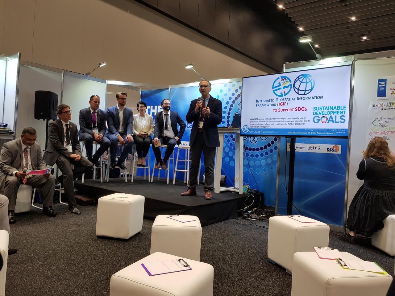
A panel on SDGs in the Locate19 Conference
10 April 2019
Professor Rajabifard was part of a panel on SDGs in the Locate19 Conference in Melbourne. He presented the UNGGIM Integrated Geospatial Information Framework (IGIF) and how this framework can enable SDGs and what are the opportunities for professional development.
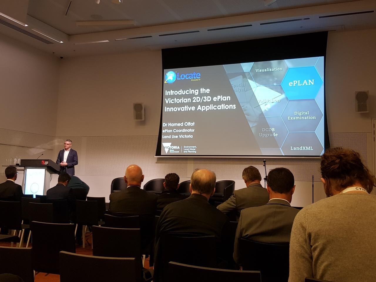
The CSDILA team and Locate19 Conference
10 April 2019
The CSDILA team attended and presented in the Locate19 Conference in Melbourne. In particular, Dr Hamed Olfat presented the Victoria 2D/3D ePlan innovative applications at this national event
IGIF First Expert Meeting
25 March 2019
Prof Abbas Rajabifard as the Chair of the UNGGIM Academic Network and the member of the joint Reference Committee of the UNGGIM and World Bank for the Integrated Geospatial Information Framework-IGIF has participated in the First Expert Consultation and Meeting on the Development of the Implementation Guide of the IGIF, on 22–23 March in the World Bank Headquarter in Washington DC.

Driving National Land Resilience
21 March 2019
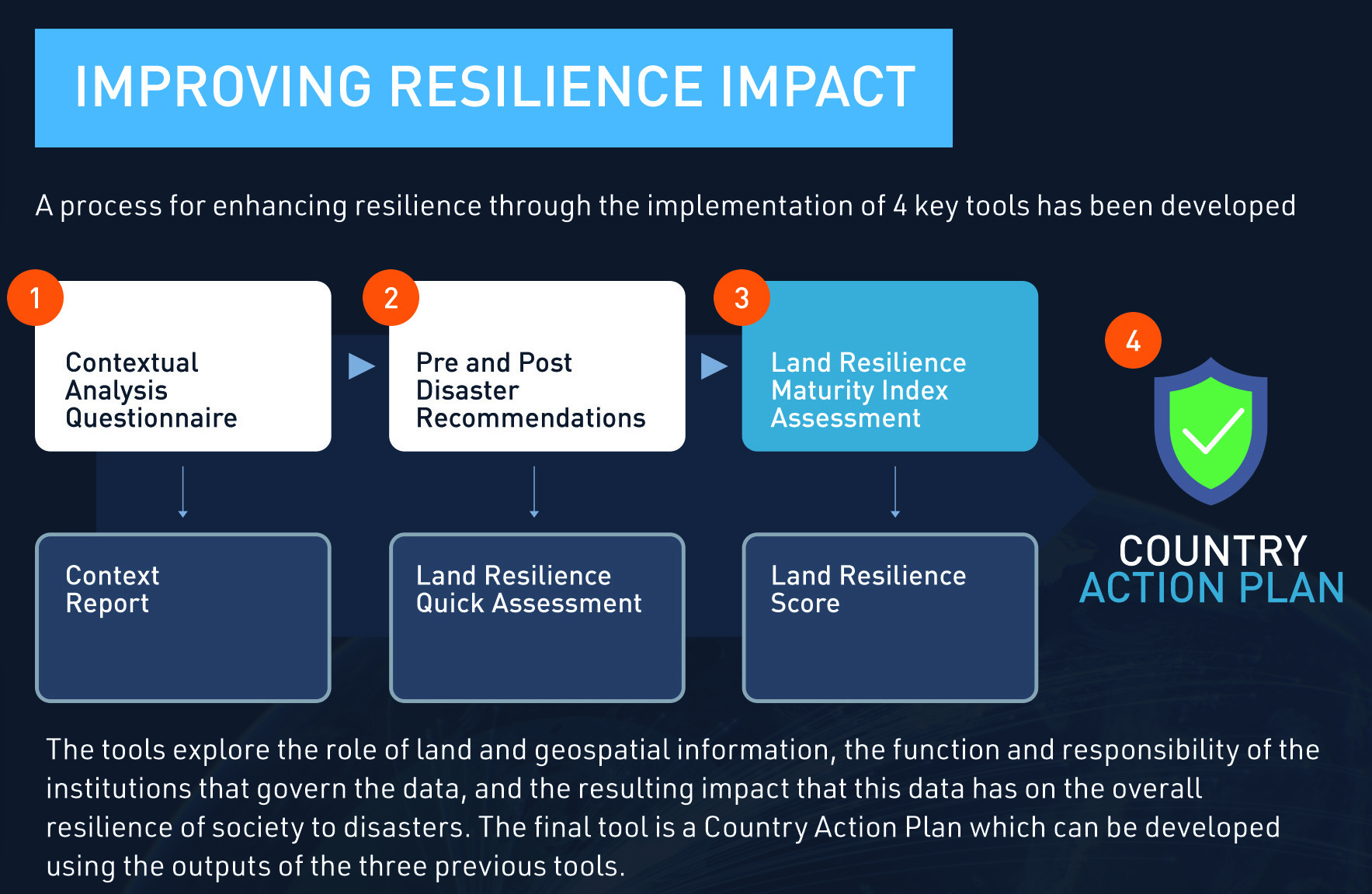
Prof Abbas Rajabifard has been invited to World Bank Global Practice Forum to present the outcomes of a recent project carried out by members of the Centre for SDIs and Land Administration in conjunction with the World Bank’s Global Land and Geospatial Unit. This work performed an in-depth investigation of the impact of National Land and Geospatial Systems on the resilience of communities looking at a number of cases at individual country levels.
The project produced several outcomes including a series of reports which feature an overarching flagship report and a standalone executive summary strategic publication, as well as four functioning tools for assessing resilience status of land and geospatial systems within country contexts and templates and guides for improving and enhancing land resilience. Next week, the project team will make several presentations during the conference event and will conduct a Masterclass event on Friday 29 March which will offer a hands-on learning experience based around the major tools and outputs developed from this project.
Visit from Professor Gary Gefferss
25 February 2019
We were pleased to welcome Professor Gary Gefferss, Conrad Blucher Institute For Surveying & Science, Texas A&M University Corpus Christi, who visited us this week to discuss potential areas for collaboration.

Successful open seminar
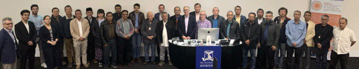
20 February 2019
We are pleased to announce the success of the open seminar on Modern Land Administration and 3D Digital Cadastre on 20 February 2019 at the University of Melbourne. Our successful event was held in partnership with Land Use Victoria (Victorian Department of Environment, Land, Water and Planning). Our successful open seminar hosted over 120 participants from government agencies and industry as well as several international delegates.
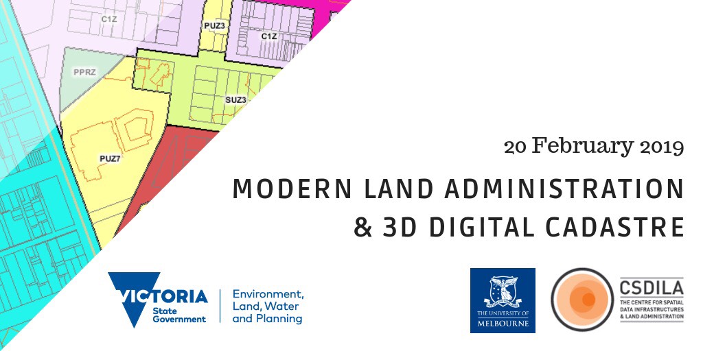
Modern Land Administration and 3D Digital Cadastre
18 February 2019
The Centre for Spatial Data Infrastructures and Land Administration (CSDILA) and Land Use Victoria (Victorian Department of Environment, Land, Water and Planning) are delighted to announce our open seminar on the latest research, practice, global trends and innovative applications in ‘Modern Land Administration and 3D Digital Cadastre’.
Time: 1:30–4:30pm
Day: Thursday 20 February 2019
Location: Lecture Theatre A1, Level 1 Engineering Block A: Building 173, The University of Melbourne VIC 3010