SmartLand Indonesia
The Word Bank Group
2019-2023
Summary
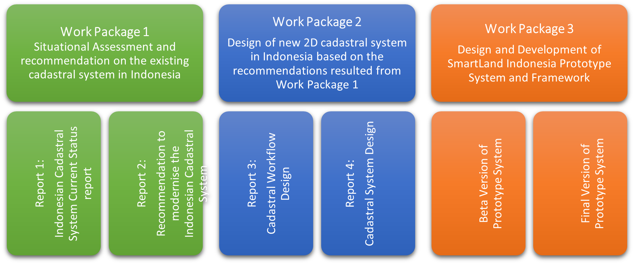
This project aimed to improve the existing land surveying and cadastral flow/process/system,
improve the data exchange system employed by relevant stakeholders in the surveying and
cadastral process, and produce valid and reliable textual and 2D data that were used for providing
information for internal and external use.
Description of the project
As part of the focus of the Government of the Republic of Indonesia on digital transformation and to ensure that the digital transformation journey was planned and executed effectively, the Ministry of Land Affairs and Spatial Planning (the Ministry of ATR/BPN) developed a strategic roadmap for Modern Land Information System (MLIS).
This project, namely ‘SmartLand Indonesia’, contributed to the MLIS realization through the aims highlighted below:
- Understood and analysed the land administration situation in the Ministry of ATR/BPN as well as regional and local land offices.
- Provided recommendations to improve the existing land surveying and cadastral workflows/business processes/systems.
- Designed a modern cadastral workflow and system based on best practices.
- Implemented a Prototype System to produce valid and reliable 2D spatial data using advanced technology adopted from worldwide best practices, in particular, CSDILA land administration modernisation solutions.
Research team
Abbas Rajabifard
Soheil Sabri
Behnam Atazadeh
Benny (Yiqun) Chen
Fatemeh Jahani Chehrehbargh
Yuke Xie
Industrial partners
Indonesia Ministry of Land Affairs and Spatial Planning (ATR/BPN)
![]()